The Aude, in the heart of Cathar Country
The Aude department is a known destination for the vast majority of mountain bikers, mainly thanks to the policy of developing cycling in general. It is enough to do a search on the web to prove the enthusiasm of mountain bikers for this department.
A resplendent sun, mild temperatures and limited rainfall, accompanied by a multitude of surfaces and landscapes, make it an ideal playground to keep the pleasure of riding in all seasons.
It must be said that this Cathar country has an ideal geographical location: the Montagne Noire to the North, the Pyrenean chain to the South, the Mediterranean Sea to the East, and the Midi-Pyrenean basin to the West. An air of the Middle Ages hovers over this territory.
This Cathar Country is made up of exceptional sites, castles, abbeys and cities testifying to the richness of the Audois heritage. With a few exceptions, you will imagine the battles that destroyed most castles. The few abbeys also show the importance of religion in these lands.
Beginners and confirmed will find through this guide a maximum of traces on all the extent of the department. From the plains to the trails, from the mountains to the Mediterranean, everything has been done to satisfy the most demanding of you.
This topo-guide allows you to navigate through superb landscapes, on a circuit or while roaming. It is obviously to your credit to respect trails and private property, in short to respect your environment and its fellows.
The cutting
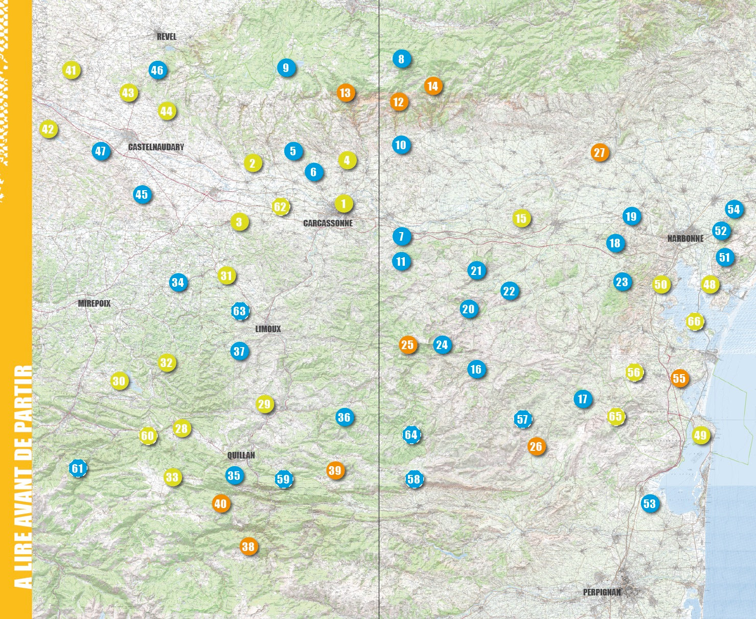
The sector-by-sector breakdown of the area covered by this VTOPO is as follows:
CARCASSONNAIS COUNTRY: The center of the department! Recognized worldwide, the City of Carcassonne and the Canal du Midi are an exceptional heritage. To the north, the Montagne Noire owes its name to its high rainfall, which favors the development of vast humid forests of deep green.
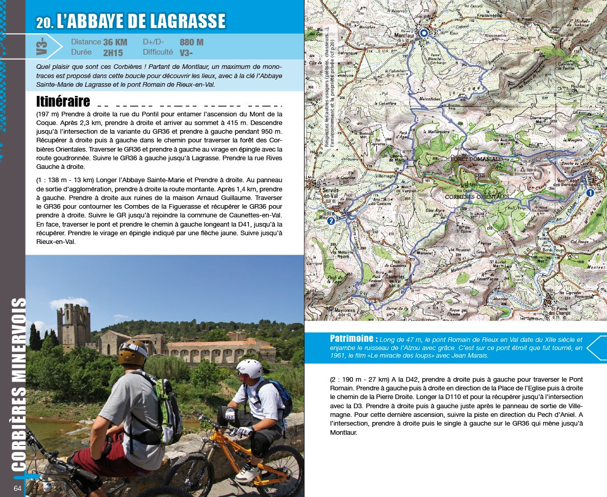
CORBIÈRES MINERVOIS: Country of castles, abbeys and vineyards, this sector is contrasted and rich in a thousand specialties and specificities. This country of rocks, vines, scrubland and monuments delight and amaze amateurs: strata, fractures and cliffs tell the story of the turbulence of the earth's crust.
LA HAUTE VALLÉE: On the edge of the mountain range of the Pyrenees, green tourism finds here one of its lands of choice and predilection. In all seasons, hiking comes in all its forms. It is a mid-mountain region, isolated, almost self-sufficient, also sharing its Cathar stories, around the blanquette and wine.
LE LAURAGAIS: The land of plenty, windmills and gastronomy! The Lauragais is a vast plain between the folds of the Piège, which separates the Aude and the Ariège, and the last reliefs of the Montagne Noire. Its Aude part ends in the west with a narrow corridor, the Sillon Lauragais, which is the privileged crossing point between Aquitaine and the Mediterranean.
LA NARBONNAISE: From Port-Leucate to Cabanes-de-Fleury, the department's coastal strip stretches over more than 50 km of fine golden sand beaches. This country of marine tradition, saltworks, oyster farming and fishing, continues to animate this Mediterranean coast now dedicated to seaside tourism.
ROUTES AUDOISES: From the sea of Port-la-Nouvelle to the mountains of Montségur in the department of Ariège, you are offered a circuit of more than 235 km divided into six stages, crossing from East to West the department from the Aude. Also, set off for five stages for a total of 255 km from Carcassonne to arrive on the sands of Saint-Pierre-sur-Mer.
- Pays : France
- Région(s) : Occitania
- Département(s) : Aude
- 66 circuits détaillés avec cartes IGN
- Format pratique 14 x 23 cm et léger 400 g
- Traces GPS au format GPX compatibles App smartphones et GPS portables
- Des infos récurrentes très utiles : variantes, région, point de vue...
- Avec le système de cotation technique VTOPO de V1 à V6
- 160 pages en couleur
- Photos
- Langue(s) : French
- Auteur(s) : Michael Sanchez
- ISBN : 9782916972596
- Date de parution : 1. April 2014
Livraison offerte (sauf MON AFGHANISTAN : un français au cœur des montagnes, livre de plus de 2kg) à partir de 60€ en France métropolitaine, Corse, Andorre et Moncaco. Tous les tarifs ici.
Expédié sous 48h dès parution.
Un lien pour télécharger vos Traces GPS vous sera envoyé par e-mail.
Les Traces GPS sont complémentaires du contenu des topo-guide VTOPO.
Nous vous déconseillons d'utiliser uniquement les Traces GPS sans la consultation du topo-guide en question.
Avec ce dernier, vous aurez accès aux niveaux de difficultés, à des recommandations, des précautions et à un descriptif détaillé, utile en cas d'erreur d'orientation. Vous aurez aussi la possibilité de visualiser des variantes et autres possibilités.

